
Understanding the DJI Zenmuse L3 Technology
The dji zenmuse l3 is a groundbreaking development in aerial surveying technology, offering advanced capabilities for professionals in various industries. Its integration of LiDAR and high-resolution imaging makes it a powerful tool for enhancing data collection and analysis. This article will delve into the technology behind the Zenmuse L3, explore its key features, and examine its diverse applications in geospatial operations.
What is the DJI Zenmuse L3?
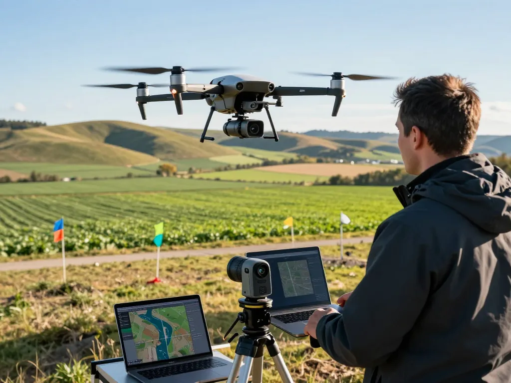
The DJI Zenmuse L3 is an innovative payload developed for the DJI Matrice series of drones, featuring a sophisticated LiDAR system combined with dual 100MP RGB cameras. This unique combination enables the capture of high-precision spatial data, essential for a variety of applications ranging from land surveying to environmental monitoring. The Zenmuse L3 is designed to meet the demands of professionals seeking accurate and efficient solutions for geospatial data acquisition.
Key Features of the Zenmuse L3
- Long-Range LiDAR Technology: The Zenmuse L3 utilizes a 1535nm LiDAR sensor capable of reaching distances up to 950 meters, even on low-reflectivity surfaces.
- Dual 100MP RGB Mapping Cameras: These cameras provide high-resolution aerial imagery, enhancing the quality of visual data collected during flights.
- High-Precision POS System: A sophisticated Position and Orientation System (POS) ensures data accuracy, crucial for mapping and surveying tasks.
- Compact and Lightweight Design: The payload’s design allows for easy integration with DJI’s Matrice drones without compromising flight stability.
- Real-Time Data Processing: The Zenmuse L3 allows for immediate data analysis, facilitating quick decision-making processes during field operations.
Applications in Aerial Surveying
The DJI Zenmuse L3 plays a crucial role in various aerial surveying applications. Its capabilities make it ideal for creating detailed topographic maps, performing 3D modeling, and conducting environmental assessments. By harnessing the power of LiDAR technology, professionals can obtain high-resolution data with centimeter-level accuracy, significantly improving the quality of surveys and analyses.
Benefits of the DJI Zenmuse L3 in Geospatial Operations
Enhanced Mapping Accuracy and Efficiency
One of the standout advantages of the Zenmuse L3 is its ability to deliver unparalleled mapping accuracy. The integration of LiDAR and dual mapping cameras ensures that users can capture detailed data even in challenging conditions. Moreover, the system’s efficiency allows for expansive coverage, enabling operators to map up to 10 km² in a single flight, making it a time-saving solution for large-scale projects.
Real-time Data Collection Advantages
The capability to collect data in real time is another significant benefit of the Zenmuse L3. This feature enables field operators to assess data quality immediately after a flight, allowing for adjustments and corrections on-the-fly. Such agility is invaluable in dynamic environments where quick decision-making is critical.
Cost-Effectiveness in Long-Term Use
Investing in the DJI Zenmuse L3 can lead to considerable cost savings over time. Its high efficiency, coupled with accurate data collection capabilities, minimizes the need for re-flights or additional surveys. As a result, organizations can complete projects more quickly and with fewer resources, maximizing operational budgets and improving overall productivity.
Applications Across Various Industries
DJI Zenmuse L3 in Agriculture
In the agriculture sector, the Zenmuse L3 is transforming how farmers monitor and manage crops. By utilizing high-resolution mapping capabilities, agricultural professionals can conduct precise field assessments, monitor crop health, and optimize irrigation practices. This data-driven approach enables sustainable farming practices and improves overall yield.
Benefits for Construction and Engineering
Construction and engineering professionals benefit from the Zenmuse L3’s ability to create detailed site surveys and 3D models of project areas. This data helps in planning, monitoring progress, and ensuring compliance with regulations, leading to improved project outcomes and reduced costs.
Environmental Monitoring and Conservation
The Zenmuse L3 is also being utilized in environmental monitoring and conservation efforts. Its capability to gather precise data on land use changes, habitat mapping, and natural resource management supports conservation initiatives and enhances environmental assessments.
Best Practices for Utilizing the DJI Zenmuse L3
Preparing for Successful Field Operations
To maximize the benefits of the DJI Zenmuse L3, thorough preparation is essential. Operators should ensure the drone is calibrated and that all equipment is in optimal condition before launching. Familiarizing oneself with flight regulations and operational guidelines is crucial for compliance and safety.
Data Processing and Analysis Techniques
Once data is collected, effective processing techniques are vital for extracting valuable insights. Utilizing specialized software for LiDAR data analysis can enhance the accuracy and usability of collected data. Techniques such as point cloud classification and 3D modeling are essential for making the most of the Zenmuse L3’s capabilities.
Maintaining Quality Control During Surveys
Implementing a robust quality control process during surveys ensures that data collection meets required standards. Regularly checking sensor calibrations and conducting test flights can help identify potential issues before the main survey, ensuring high-quality output.
Future Trends and Innovations for 2026 and Beyond
Emerging Technologies Complementing the Zenmuse L3
The landscape of aerial surveying is continually evolving, with new technologies enhancing the capabilities of systems like the Zenmuse L3. Innovations in artificial intelligence (AI) and machine learning are set to revolutionize data analysis, allowing for more intelligent data interpretation and insights.
Predictions for the Evolution of Aerial Surveying
As technology advances, aerial surveying will become even more integral to various industries. The incorporation of autonomous drones, improved battery life, and enhanced sensor technologies will expand the applications and efficiency of systems like the Zenmuse L3. These developments will empower professionals to tackle increasingly complex surveying tasks with greater ease.
Training and Development for Professionals
To harness the full potential of the DJI Zenmuse L3, ongoing training and professional development are crucial. Organizations should invest in training programs that enhance operational expertise and data analysis capabilities, ensuring that teams are well-equipped to leverage this advanced technology effectively.
What are the main features of the DJI Zenmuse L3?
The main features of the DJI Zenmuse L3 include its advanced LiDAR sensor technology, dual 100MP RGB cameras, a high-precision POS system, and its compact design, all of which contribute to its effectiveness in various surveying applications.
How does the Zenmuse L3 compare to other LiDAR systems?
Compared to other LiDAR systems, the Zenmuse L3 stands out due to its integration of high-resolution cameras and advanced mapping capabilities, delivering superior accuracy and efficiency for aerial surveys in diverse environments.
What are the best practices for aerial surveying with drones?
Best practices for aerial surveying with drones involve thorough preparation, implementing quality control measures, utilizing advanced data processing techniques, and staying informed about the latest technological advancements in the field.
What industries benefit most from using the DJI Zenmuse L3?
Industries that greatly benefit from the DJI Zenmuse L3 include agriculture, construction, engineering, environmental conservation, and surveying, owing to its diverse applications and ability to enhance data accuracy and efficiency.
What future developments can we expect for the Zenmuse line?
Future developments for the Zenmuse line are likely to include enhancements in AI integration, improved sensor capabilities, and expanded applications in emerging fields, further solidifying its position as a leader in aerial surveying technology.